OUR JOB AND OUR POWER; SPATIAL INFORMATION WE PROVIDE GEOGRAPHIC ANALYSIS SOLUTIONS FOR AIRPORTS
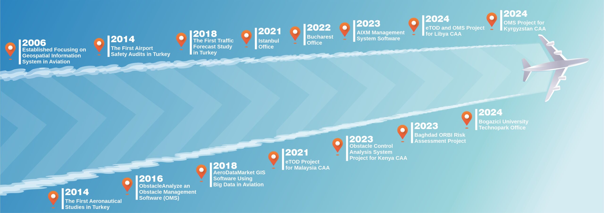
Haritaevi was established in 2006 to focus on Spatial Information Systems in aviation. The foundations of our software projects were laid in Bilkent University Cyberpark Technology Development Zone in 2012. Our adventure in the aviation industry, we started in 2014 by completing the first aeronautical studies in Turkey, accelerated in 2016 with our development of ObstacleAnalyze, an Obstacle Management Software, and Airport Safety Audits. Continuing to break new ground in Turkey, we conducted the first Traffic Forecast Study in 2018. In the same year, we launched AeroDataMarket, a Geographical Information System (GIS) software using Big Data in Aviation. We improved global collaborations in 2019 on the way we set out with great ambition and enthusiasm. In 2020, we became the first company in Turkey received an International Aviation Certificate by breaking new ground. In our adventure, we opened our Istanbul Office in 2021. We were born in Ankara, we are opening up to the world from Istanbul connecting Asia and Europe.
Continuing on this path, in 2021, we completed the eTOD project for the Malaysian Civil Aviation Authority at 21 airports. In 2022, we opened our Bucharest Office, and in 2023, we made the first international sale of the Obstacle Management System to the Kenyan Civil Aviation Authority. Additionally, in the same year, we launched the AIXM Management System Software. In 2024, we further expanded our presence by opening our Istanbul Bogazici University Technopark office.


