Producing Precision Navigation Tools for Aviation:
At Haritaevi Aviation, we are dedicated to producing the highest quality aeronautical charts for the aviation industry. Our charts are produced in accordance with the standards set by the International Civil Aviation Organization (ICAO) and are used by pilots, air traffic controllers, and other aviation professionals to navigate and plan flights safely and efficiently.
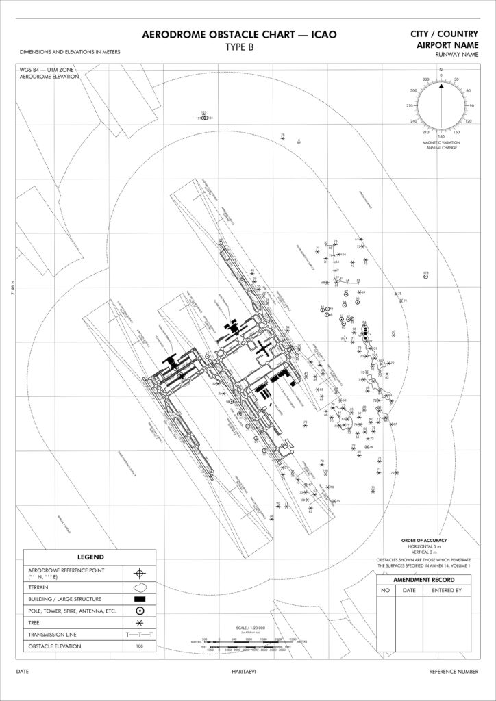
Aerodrome Obstacle Charts: Enhancing Safety and Precision:
Type A and Type B Charts for 21 Malaysian Airports
One of our areas of expertise is the production of Aerodrome Obstacle Charts, specifically Type A and Type B, which provide detailed information about obstacles located around an airport or aerodrome. We are proud to say that we produced Aerodrome Obstacle Charts Type A and Type B for 21 airports in Malaysia, which are essential for pilots to identify and avoid obstacles that could pose a hazard during takeoff or landing, and also used for flight planning.
Customization for Local Needs:
Furthermore, our charts are not just standard templates. We have the flexibility to tailor them to incorporate specific requirements mandated by local authorities or individual clients. This approach ensures that our charts provide the utmost relevance and accuracy for each unique aviation environment.
Precision Approach Terrain Charts: Elevating Landings:
Specialized Terrain Charts for Kuala Lumpur International Airport
In addition to Aerodrome Obstacle Charts, we also specialize in producing Precision Approach Terrain Charts. We produced Precision Approach Terrain Charts specifically for Kuala Lumpur International Airport since it has runways that serve precision approach CAT II operations. These charts provide detailed and precise information about the terrain and obstacles in Area 4. These charts are an essential tool for determining decision height to provide safe and efficient landings.
Adaptability to Local Needs:
As with our other chart offerings, these Precision Approach Terrain Charts can also be customized to accommodate specific demands set by local authorities or individual clients, ensuring an accurate fit for diverse aviation scenarios.
Comprehensive Chart Offerings:
Beyond Aerodrome Obstacle and Precision Approach Terrain Charts, We also provide a diverse range of other essential charts. These include aerodrome charts, enroute charts, terminal area charts, and approach charts.
Continuous Updates for Accuracy:
As aviation environments evolve, so do our charts. We offer the option to update charts based on client requests, ensuring that our offerings remain in sync with the latest data and information. This commitment to accuracy underscores our dedication to ensuring the safety and efficiency of flight operations.