Aerodrome Mapping Database (AMDB) and Aerodrome Surface Routing Network (ASRN) are specialized Geographic Information System (GIS) databases that revolutionize the aviation industry. These advanced solutions bring unparalleled accuracy and efficiency to aviation operations.
AMDB-ASRN: Navigating Airports with Precision and Enhancing Taxi Routing
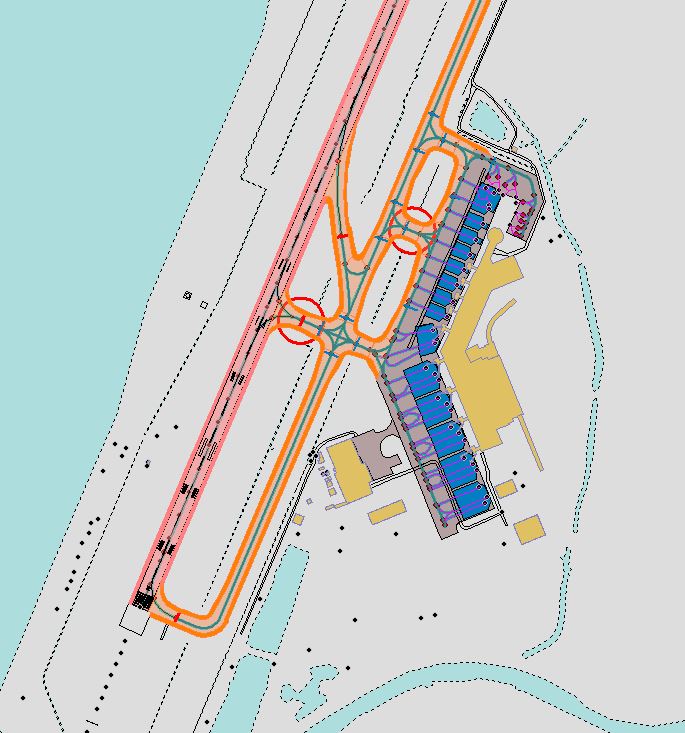
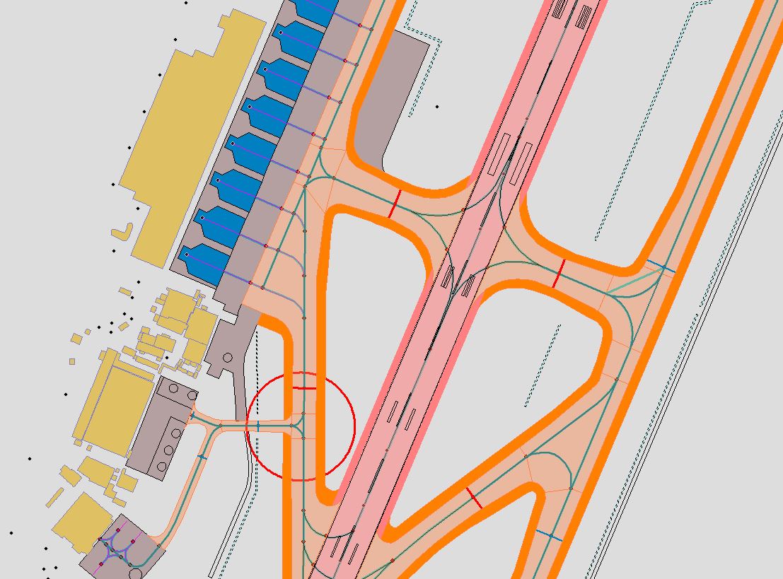
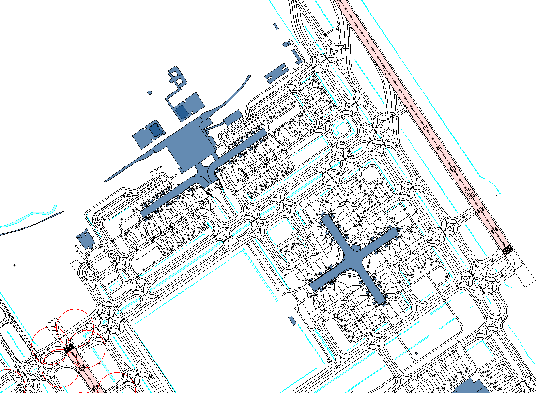
AMDB provides a comprehensive spatial layout of airports, encompassing runways, taxiways, aprons, buildings, and more, with attributes that enhance operational efficiency and safety.
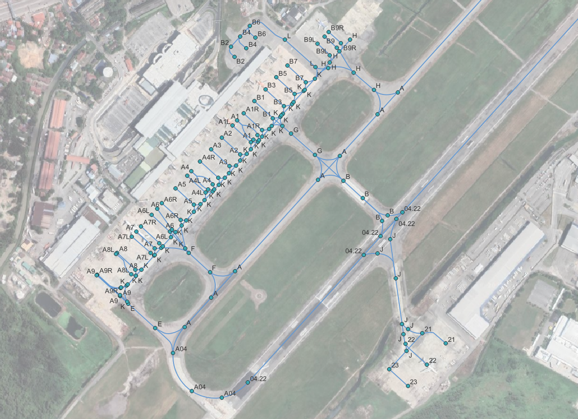
ASRN, on the other hand, supports taxi routing functions, offering directional connections and precise route transmission for onboard applications.
Versatile Applications: Beyond Expectations
Our powerful AMDB and ASRN solutions offer a wide range of applications, from digital chart production, traffic awareness, taxi route determination, NOTAM visualization and runway incursion prevention to facility and resource management, emergency response, and safety enhancements.
Setting Industry Standards: Our Commitment to Excellence
As Haritaevi Aviation, we pride ourselves on delivering top-notch Aerodrome Mapping Database (AMDB) and Aerodrome Surface Routing Network (ASRN) solutions, setting the industry standard with our commitment to excellence and compliance with international regulations and standards. We are proud to have successfully produced AMDB for 21 airports and ASRN for 9 airports for Civil Aviation Authority Malaysia.
Modern Data Acquisition Techniques: Our expert team of skilled professionals employs modern and high-quality data acquisition techniques to capture precise spatial information of aerodrome features. From photogrammetric imaging to terrestrial surveys, we leave no stone unturned in creating AMDBs of unparalleled accuracy and integrity.
Compliance with International Standards: Our team of experts creates AMDB and ASRN products, ensuring they adhere to the highest international standards. We strictly follow the guidelines set forth by RTCA DO-272 / EUROCAE ED-99, RTCA DO-291 / EUROCAE ED-119, and ICAO Doc 9881, guaranteeing data accuracy, reliability, and safety for all aviation applications.
Tailored to Your Needs: Understanding that each customer’s requirements are unique, we take a personalized approach to our services. Our AMDB and ASRN solutions are customized to suit your specific operational needs, enhancing efficiency and safety at your aerodrome.
Expert Team: With years of experience in the aviation industry, our dedicated team of professionals brings unparalleled expertise to every project. From data capturing methodologies to GIS integration, our comprehensive knowledge ensures impeccable results.
Safety First: Safety is at the core of our mission. We understand the critical role that accurate and reliable aerodrome data plays in ensuring smooth operations and avoiding potential hazards. Rest assured, our AMDB and ASRN solutions prioritize safety above all else.
Trustworthy Collaboration: We foster strong partnerships with our clients, prioritizing clear communication and collaboration throughout the project’s lifecycle. Your input is invaluable, and we work closely with you to meet your objectives effectively.
Haritaevi Aviation is committed to providing industry-leading AMDB and ASRN solutions that pave the way for a safer, more efficient, and seamless aviation experience. With our dedication to adhering to international standards and meeting our customers’ specific requirements, we have established ourselves as trusted partners in the aviation community. Our commitment to enhancing product quality drives us to stay up-to-date with the latest advancements in data collection methods and geographic information systems. We continuously strive to improve our offerings through continuous learning and adaptation to cutting-edge technologies to shape the future of aviation.
OUR PROJECTS