What is eTOD?
An Electronic Terrain and Obstacle Database (eTOD) is a digital representation of the Earth’s topography and man-made obstacles both of which are essential elements for aviation safety and aeronautical navigation. This digital representation plays a pivotal role in ensuring safety and efficiency of air travel by providing aviators and aviation systems with accurate, reliable, and up-to-date information.
Our Commitment to Excellence:
As Haritaevi, with our commitment to excellence and compliance with international regulations and standards, we provide top-notch Electronic Terrain and Obstacle Database (eTOD) solutions that that not only meet industry standards but set new benchmarks. Our team consists of skilled professionals with extensive expertise in geospatial data processing, aviation regulations, and eTOD creation.
Our Proven Project:
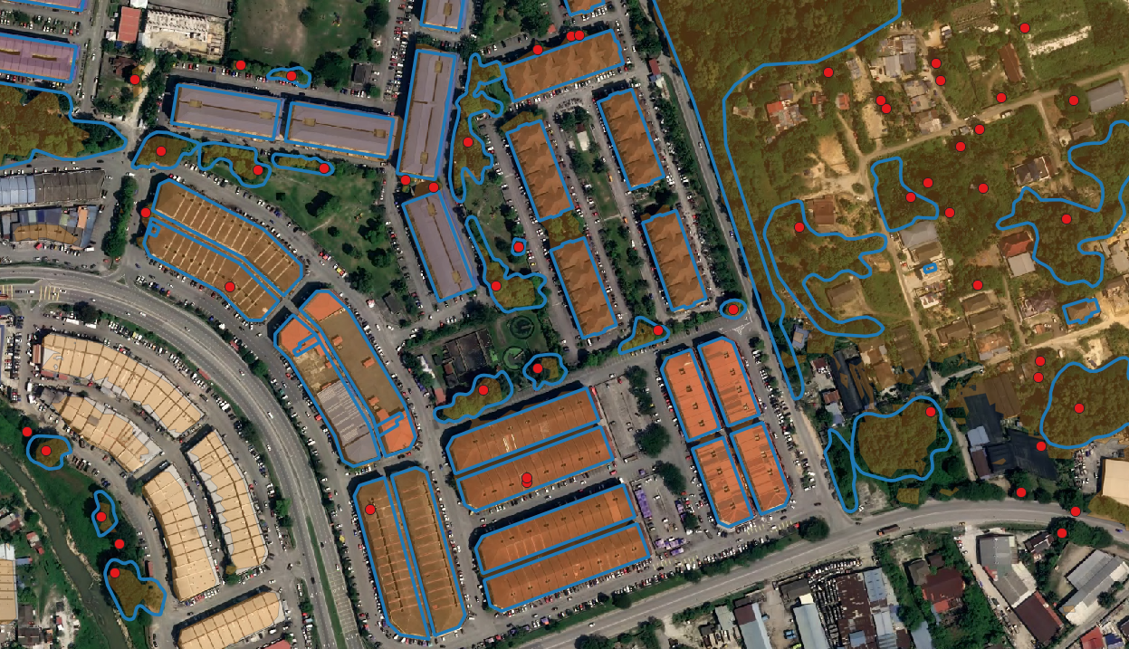
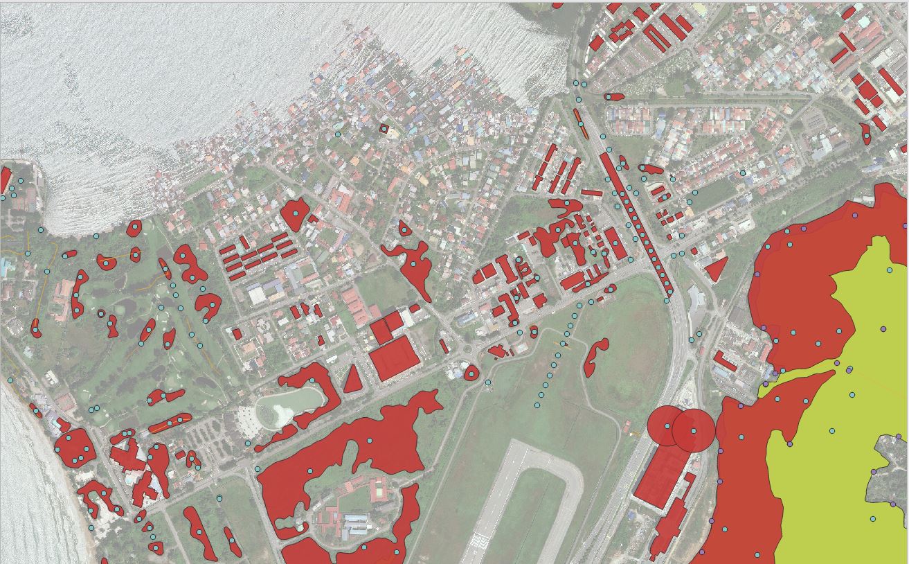
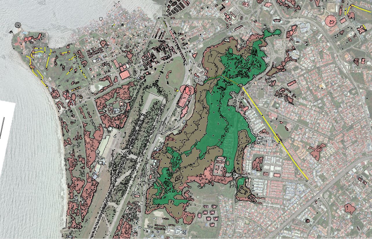
Our success is marked by the creation of eTODs for 21 airports in Malaysia, showing our expertise and dedication to enhancing aviation safety through meticulous data management and expert-driven solutions.
Ensuring Reliable Precision in Aviation:
At Haritaevi, we provide more than just data – we offer trust. Our careful approach guarantees:
High Accuracy Datasets:
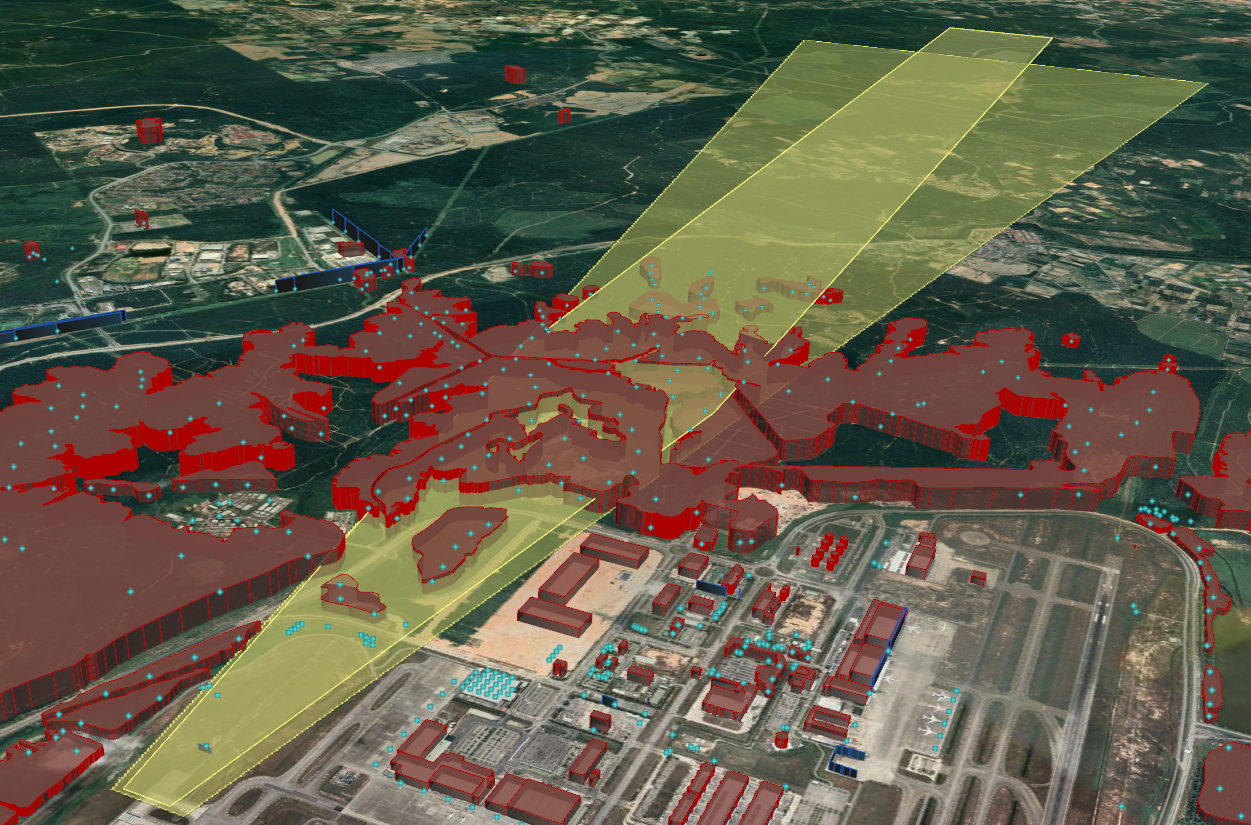
Accurate eTOD datasets are essential for aviation safety and operational efficiency. The eTOD dataset helps pilots, air traffic controllers, and aviation systems to make accurate data-driven decisions, avoid obstacles, plan flight paths, and ensure smooth take-off and landings. Outdated or inaccurate eTODs could lead to serious safety incidents. Our eTOD dataset creation process is meticulously designed to ensure the highest level of accuracy and reliability.
Wide Range Data Sources:
Haritaevi gathers an extensive array of data sources, including satellite imagery, LiDAR data, aerial photographs, and geospatial information from confirmed and verified reputable sources. Our data acquisition process is comprehensive and designed to capture both natural terrain features and man-made obstacles.
Adherence to the Latest International Standards:
Our eTOD creation process conforms to international aviation standards and regulations, guaranteeing that the data complies with the most up-to-date international requirements.
Database Creation:
The collected data undergoes thorough processing to create a detailed and precise digital representation within a GIS environment. Advanced software tools are utilized to convert raw data into usable eTOD formats, considering factors like elevation, land cover, obstructions, and more.
Ensuring High Quality:
Data Quality Verification is a crucial stage within our eTOD creation process. Our team of experts meticulously examines and validates the data to ensure precision and quality. We place a high priority on accuracy and quality assurance, thereby ensuring the dependability and up-to-date nature of the eTOD data we supply. Any inconsistencies are promptly resolved by our specialists, further enhancing the reliability of the final eTOD product.
Updating and Maintenance:
The data in the eTOD dataset is not static; it needs to be updated regularly to reflect environmental changes. We recognize the importance of accurate and up-to-date information in aviation. Well-established processes ensure that the data in the eTOD dataset is created and updated on time. To this end, our team of experts continuously monitors data sources and performs the necessary updates to ensure that the data in the eTOD dataset remains current and reliable.
At Haritaevi, we take pride in our role as a reliable provider of Electronic Terrain and Obstacle Databases (eTODs). Our commitment to accuracy, compliance, and customer satisfaction sets us apart as a distinct partner that ensures aviation safety and operational efficiency in a trustworthy manner. Feel free to reach out to us to learn how we can offer support tailored to your needs. Furthermore, we have the capability to incorporate technical details and content that will capture the attention of our customers.
If you would like to get information about eTOD training given by Haritaevi’s experienced team, please click here.
OUR PROJECTS